Open Position:
Senior Remote Sensing Engineer
More information on Company/Open Positions
your information gateway
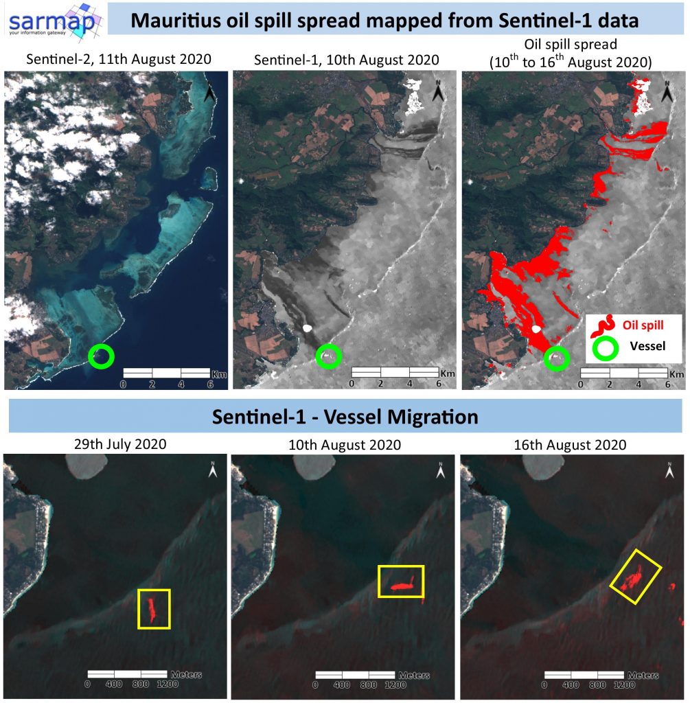
SAR Sentinel-1 data proved their great potential on mapping the oil leakage environmental catastrophe affecting the Mauritius in the last days.
The traces of the oil spreading on the Blue Bay Marine Park are easily visible on SAR Sentinel-1 data compared to the optical Sentinel-2 image.
The maximum extension of the spill has been detected using SARscape and ENVI tools.
The vessel ran aground on a coral reef on 25 July and the leakage started on the 6th August. The migration of the vessel after its breakage has also been mapped through Sentinel-1 SAR data.
Image Details:
Copernicus Sentinel-1, track 78, VV polarization
Copernicus Sentinel-2
Processing tools:
ENVI 5.5.3
SARscape 5.5.3, Intensity Time Series
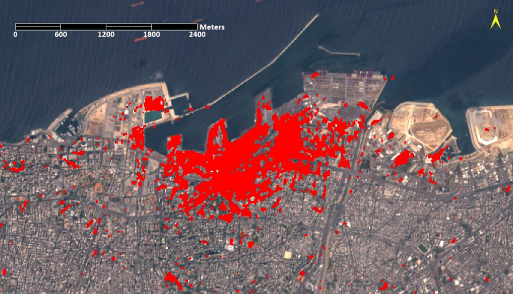
Sentinel-1 data from the Copernicus program were used to rapidly map the explosion extent.
SARscape automatic workflow shows a SAR Coherence Change Detection classification, which highlights the damaged area (red color).
For more information, please visit the link below:
We are pleased to announce the new release of SARscape 5.5.3 and SARscape Analytics Toolbox 5.5.3
SARscape Analytics Toolbox is the new version of SARscape Analytics Engine, the independent product for ENVI and ArcGIS Pro.
For more information visit :
Please, contact your local Harris distributor to get SARscape.
The Applications and Benefits of Synthetic Aperture Radar (SAR)
Thurday, December 6, 2018
Register for the webinar by clicking on the link


OPTICALSCAPE 5.4.1 has been released!
For further information, please contact your local Harris distributor