
With the ability to mount digital optical devices on low cost Unmanned Aerial Vehicle (UAV) platforms, the generation of Digital Surface Models (DSM) has become a major component for an extensive number of applications at local scale, such as mapping, virtual terrain reconstruction and visualization, simulations, civil engineering, precision farming, precision forestry and others. This DSM category complements the more conventional one based on satellite, airborne and terrestrial imagery, which, in the same period, has seen an important evolution in terms of resolution and acquisition technology.
Optical temporal analysis is typically carried out using 8-/16-days temporal composites derived from medium resolution data, such as MODIS. The combination of Sentinel-2 and Landsat-8 high resolution time-series complements the more conventional MODIS based one by providing a higher level of detail, particularly important in agricultural related applications.
Modules
Opticalscape – available in ENVI and QGIS environment – is a modular set of functions supporting:
- The generation of DSMs based on satellite, UAV, airborne, and terrestrial stereo images. DSM and ortho-rectified mosaic are generated via workflows in an automated way, or alternatively, step-by-step, according to preset functionalities.
- The automated generation of medium and high resolution of mosaiced indexes and/or spectral bands including the provision of temporal descriptors.
Space Stereo
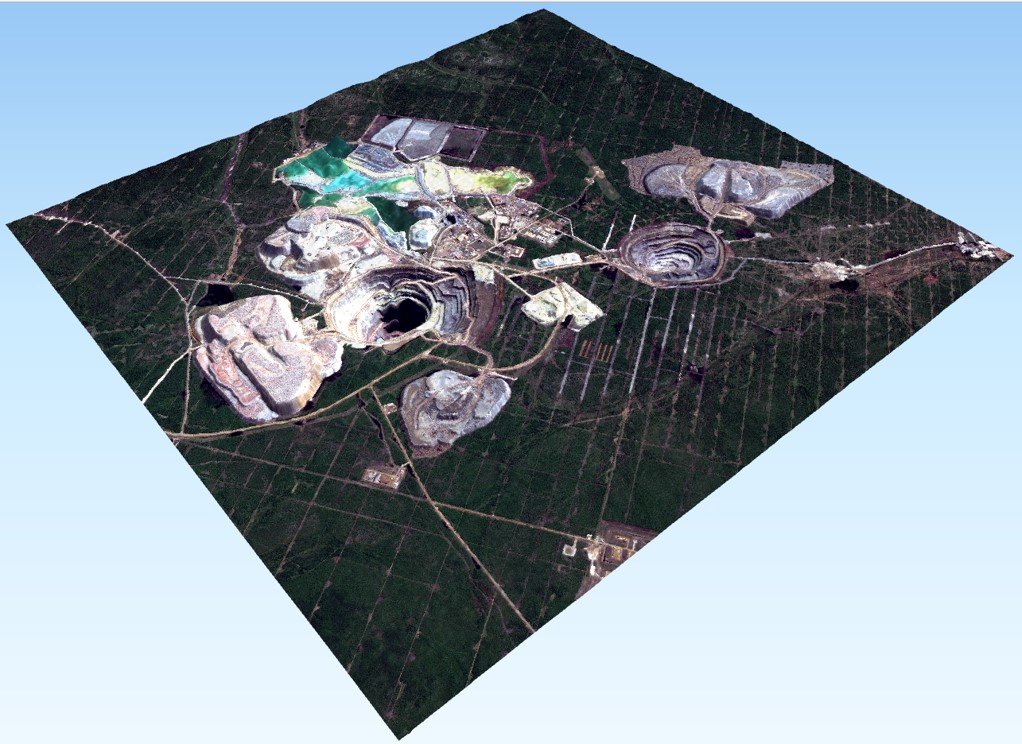
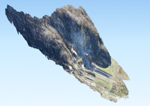
It supports the processing of all existing satellite stereo and tri-stereo data in terms of image orientation to automatic DSM and ortho-image generation. Key feature is the DSM generation, which is based on the most advanced algorithms thoroughly considering the new sensors characteristics. The figure – generated using SPOT-7 data – illustrates a 3D view of an industrial mine.
UAV & Airborne Stereo
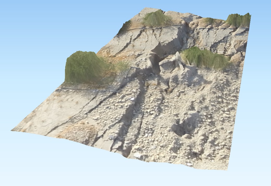
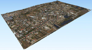
It supports the processing of image pair series acquired from digital camera devices mounted either on UAV or aircraft platforms. Key feature is the DSM generation, which is based on the most advanced algorithms, and the automated DSM and ortho-image mosaicing. In order to facilitate the image orientation, images must include a coarse platform position, while attitude data are not mandatory. The figure top – which includes 450 images acquired by UAV Dji Phantom 4 – illustrates a 3D image view of a sinkhole region, while on the bottom, an urban area represented in a 3D image view consisting of 150 images acquired by Phase One camera mounted on an aircraft.
Terrestrial Stereo
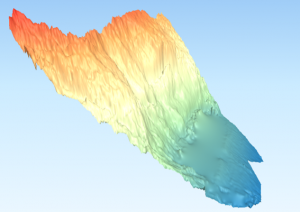
It supports the processing of image pair series acquired from digital camera devices mounted on a tripod. Key feature is the DSM generation, which is based on the most advanced algorithms, and the automated DSM and ortho-image mosaicing. In order to facilitate the image orientation, images must include a precise camera position. The figures – which consist of 10 images – illustrates a 3D side view – DSM and ortho-rectified mosaic – of an open pit.
Space Multi-Temporal
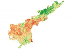
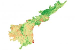
It supports the automated downloading and processing of MODIS, Landsat-5/8 and Sentinel-2 data. Key feature is the automated generation of mosaiced indexes and/or spectral bands and the provision of temporal descriptors. The figures below show a state-wide (Andhra Pradesh, India) NDVI mosaic for January (top) and June (bottom) 2018 by combining Sentinel-2 and Landsat-8 time-series.
Further information
7th, April 2022