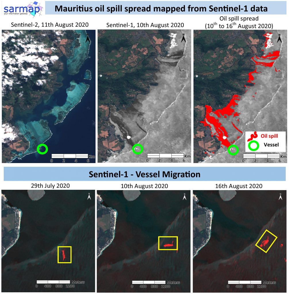
SAR Sentinel-1 data proved their great potential on mapping the oil leakage environmental catastrophe affecting the Mauritius in the last days.
The traces of the oil spreading on the Blue Bay Marine Park are easily visible on SAR Sentinel-1 data compared to the optical Sentinel-2 image.
The maximum extension of the spill has been detected using SARscape and ENVI tools.
The vessel ran aground on a coral reef on 25 July and the leakage started on the 6th August. The migration of the vessel after its breakage has also been mapped through Sentinel-1 SAR data.
Image Details:
Copernicus Sentinel-1, track 78, VV polarization
Copernicus Sentinel-2
Processing tools:
ENVI 5.5.3
SARscape 5.5.3, Intensity Time Series