🌟 Exciting News! SARscape 6.1.0 is Here! 🚀
We’re thrilled to introduce the latest release of SARscape, packed with new features and algorithmic enhancements designed to elevate your geospatial analysis experience.
The most meaningful developments are:
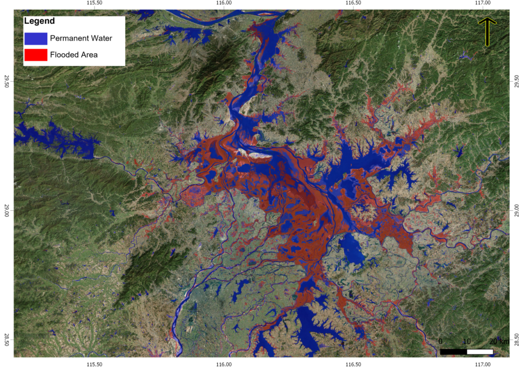
– Flooding Map Tool: New tool to generate flood maps with ease.
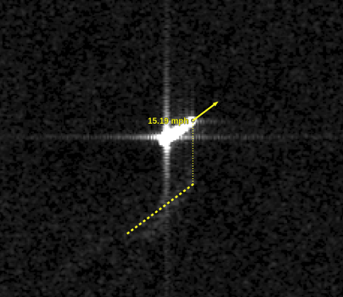
– Velocity Estimation: New tool to determine the speed of moving targets in SAR imagery.
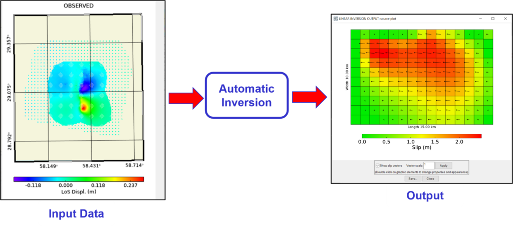
– Automatic Displacement Modeling: This innovative tool autonomously handles both non-linear and linear inversion sequences to calculate the slip distribution of seismic events.
🛰Furthermore, SARscape 6.1.0 introduces support for several new SAR spaceborne sensors, including data from the upcoming #NISAR mission. Explore the complete list of new tools and improvements in the official Release Notes.
Reach out to your local NV5 Geospatial Software distributor to get SARscape 6.1.0.
#SARscape #SAR #Innovation #GeospatialSolutions #RemoteSensing